I know th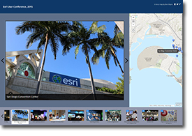 at Esri story maps have been around for quite a while, but I am only finally learning how to create them now. For some reason, I was quite resistant to using them, but now that I have created a couple I have to say they could be really useful for teaching both GIS and just about anything geographical (I know my friends at Esri would be rolling their eyes – what can I say, I’m a slow learner!). The user interface for creating them could still use some tweaks, as I found there was a lot of clicking involved, but I have not yet tried uploading using a CSV file, which I have a feeling would alleviate that problem.
The first story map I created uses photos I took on a little walking tour from my hotel to Stanley Park and back in Vancouver, when I was there for the Canadian Association of Geographers Conference in June. I have a GPS receiver for my Canon 70D and I have to say it works like a charm! The receiver gets a signal within a couple of minutes, and then my photos are automatically geotagged. Of course, I also used my MotionX GPS app to record my track, which I have included in the story map as a separate map layer. It was a cloudy day, so the photos aren’t exactly spectacular, but it’s not too bad as a first effort. Maybe I’m just too new to this, but the embedded version below doesn’t seem as intuitive as the “full” version when it’s opened in a new window. (Edit: I tweaked the widths of my website page elements, so now the embedded versions render in their correct, “full” versions – much better. I also changed the Vancouver base map to satellite imagery).
I hope to experiment with the different templates available in the future but, for now, the basic walking tour format seemed to work best. I have also created one with photos from the Esri Education GIS Conference and main User Conference (click here to open in a new window):
Note: one thing I have noticed is that, if my browser window is too large, or too tall and skinny, the story map doesn’t render properly. I read on GeoNet that apparently it interprets the dimensions as being on a mobile device – Esri is working on fixing this. If this happens, you can just reduce the height of your browser window until it renders it correctly (it seems to want to be wider than high).
This first foray into Esri’s online applications is part of my new commitment to making better use of the Esri platform, beyond the traditional desktop suite. While I was at the User Conference, I had an “aha!” moment where I realized that all of the various components that Esri has been talking about for the past two or three years have matured and coalesced into a coherent and powerful platform. I’m sure that was their plan all along, but I have a feeling I’m not the only user who’s taken a while to figure out what it all means.
Leave a Reply